

REGIONAL BEACH MONITORING PROGRAM - SAN DIEGO COUNTY
Client: San Diego Association of Governments (SANDAG)
The evolving nature of the monitoring program reflects an on-going collaboration between SANDAG and Coastal Frontiers to sharpen the focus of the effort while addressing the changing needs of SANDAG's constituents. The current program consists of a beach component and a lagoon entrance component, with specific tasks listed below.
Study Tasks
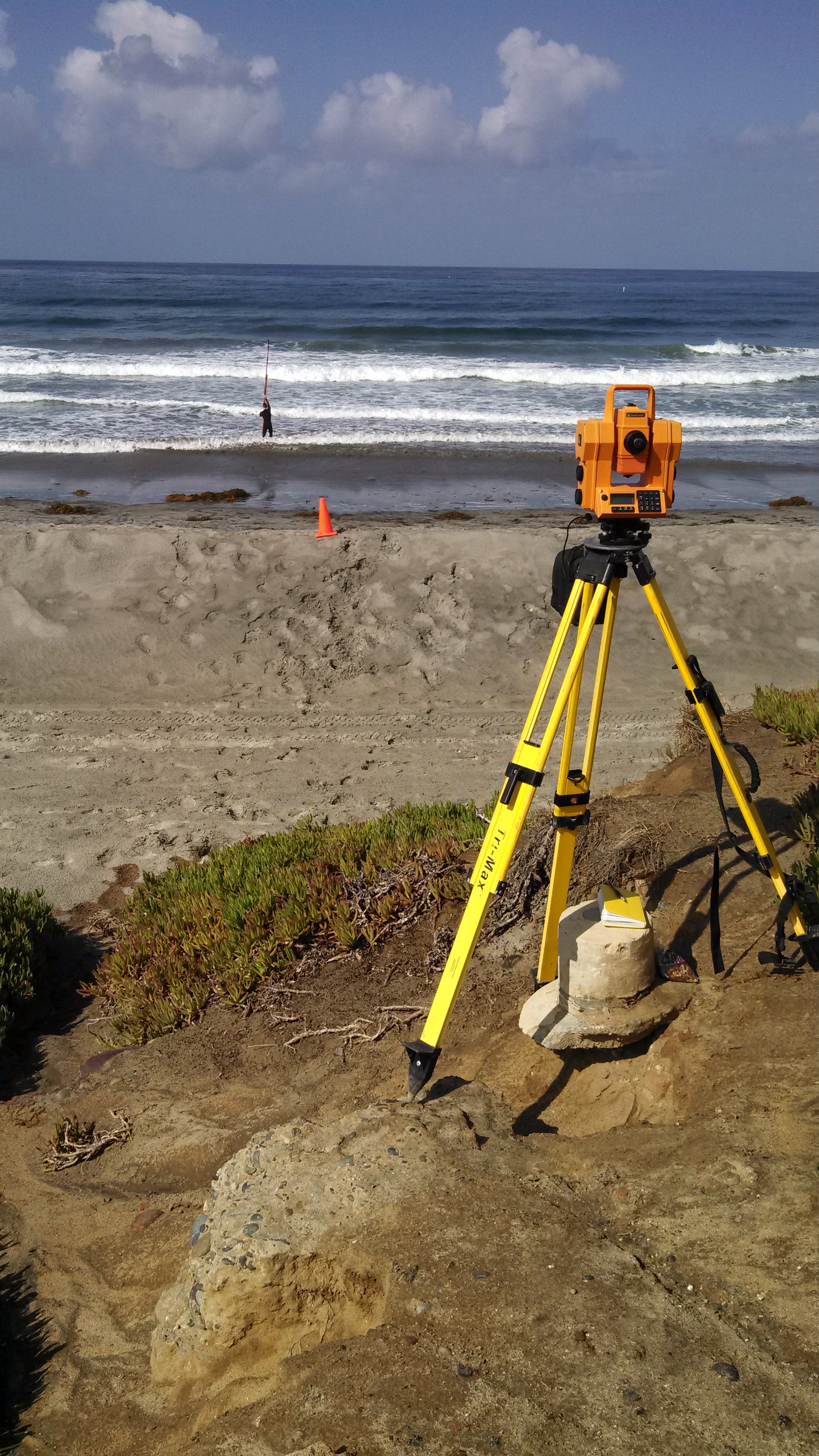
Semi-annual beach profile surveys at up to 61 shore-perpendicular transects located between Oceanside and the U.S.-Mexico border
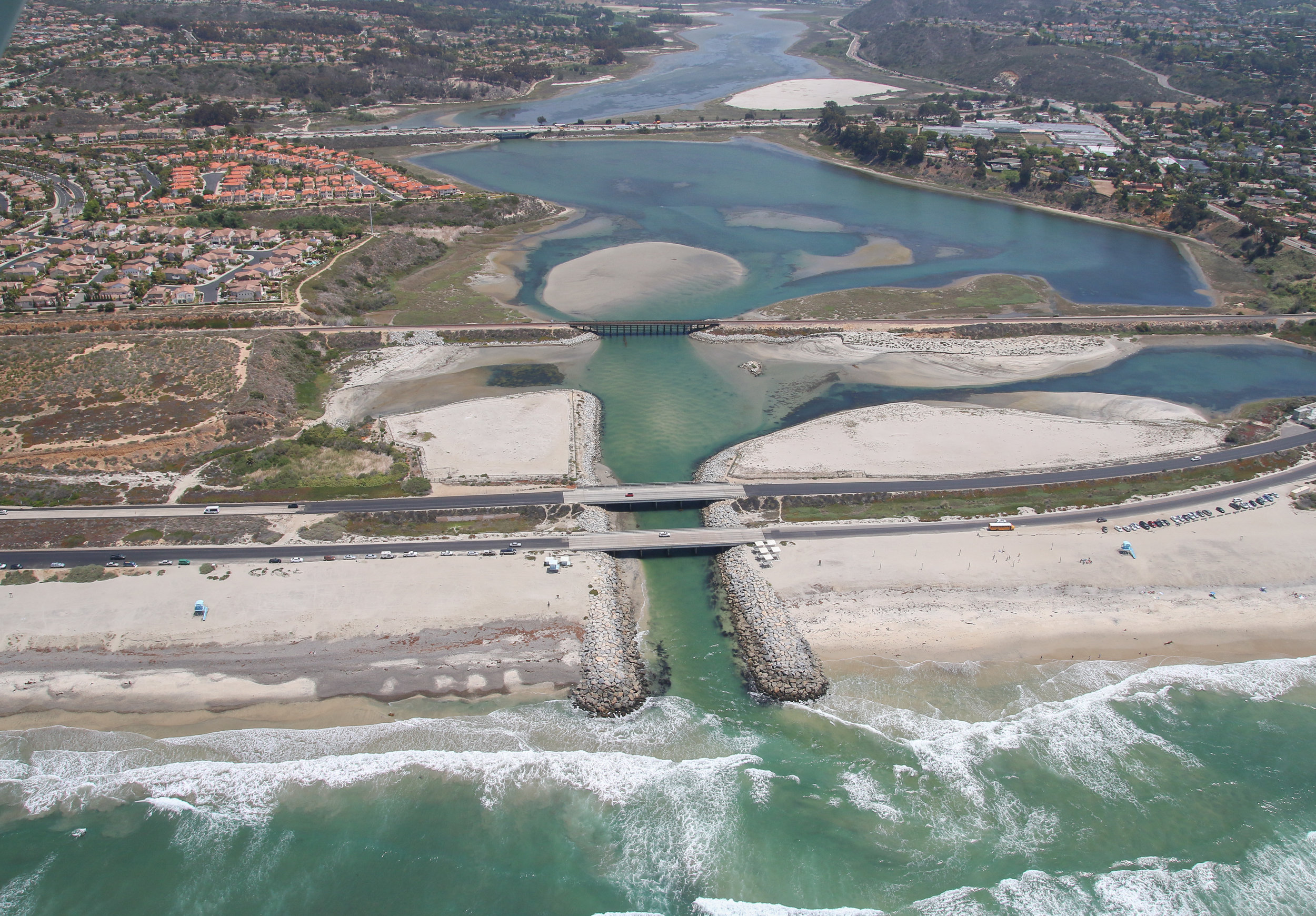
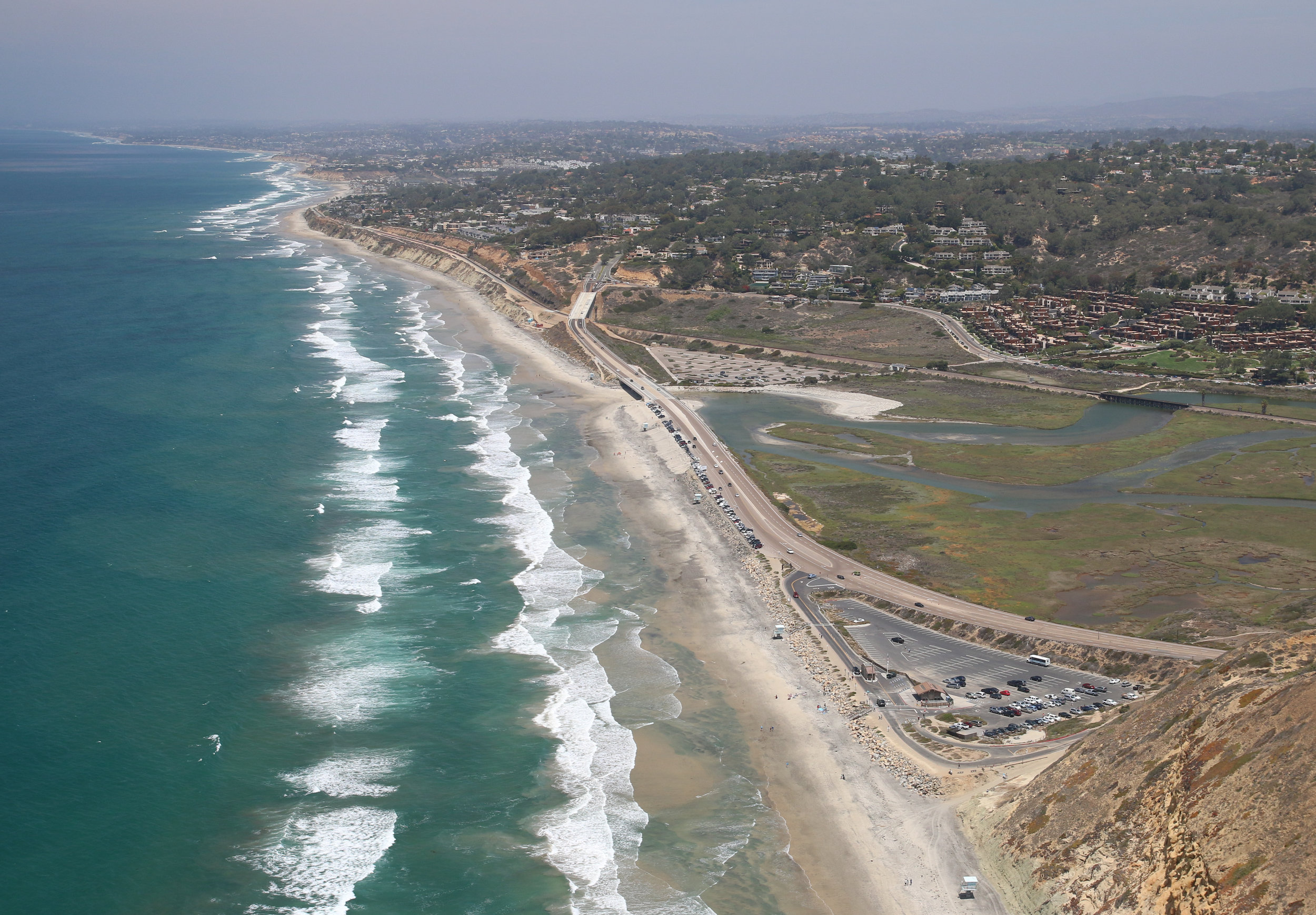
Annual oblique aerial photographs of beaches and lagoon entrances
Annual assessments of beach condition based on an analysis of changes in shoreline position and shorezone volume
Annual assessments of lagoon entrance condition based on closure records and maintenance activities (dredging and mechanical openings)
The County of San Diego derives significant economic, recreational, and aesthetic benefits from its beaches. To better understand the relevant coastal sediment processes and optimize the design of periodic regional beach nourishment programs, SANDAG engaged Coastal Frontiers to develop and implement a cost-effective and sustainable beach monitoring program in 1996. Coastal Frontiers personnel have conducted semi-annual surveys and provided annual assessments of beach conditions since that time.
While the general objective of the program is to document changes in the condition of the shorezone while evaluating the impacts of natural events and human intervention, the focus in recent years has been the fate of nearly 2.1 million cubic yards of sand nourishment placed on the beaches in 2001 as part of the Regional Beach Sand Project (RBSP). The lessons learned from this project have facilitated the planning, design and funding of a second beach nourishment effort (RBSP II) proposed for 2012.